
Welcome to the Mountains
Sightseeing
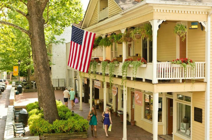
Dahlonega
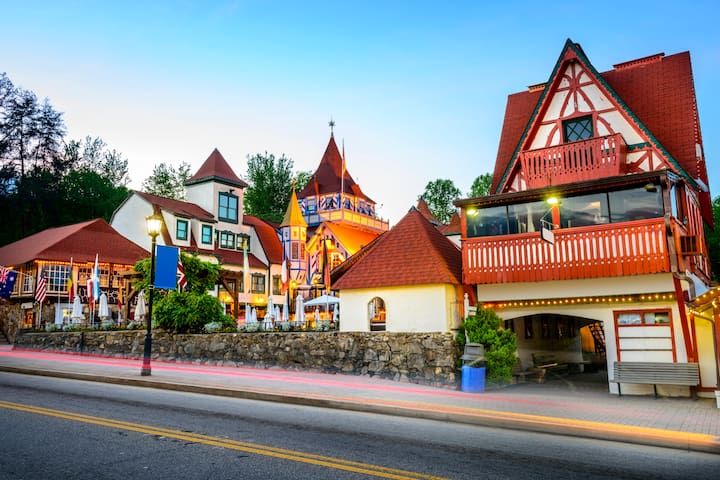
Helen
Blairsville
Wineries
Kaya Vineyard & Winery
5400 Town Creek Rd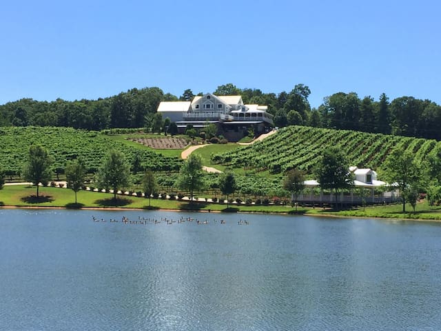
Frogtown Cellars
700 Ridge Point Dr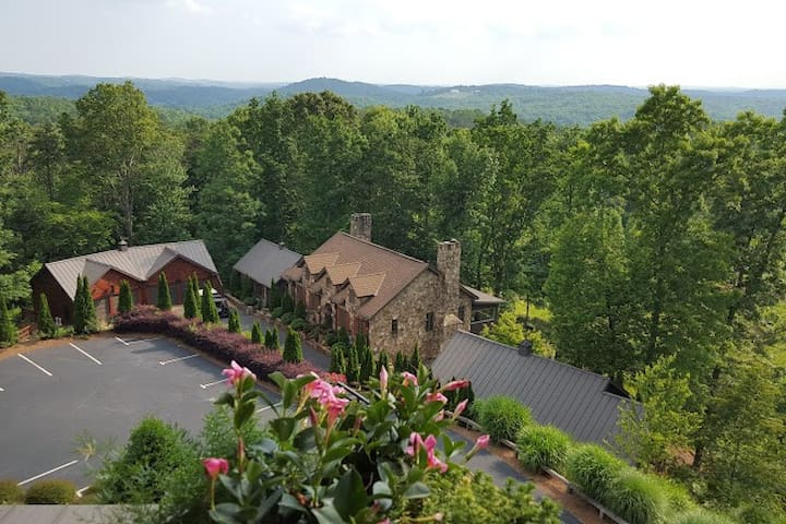
Wolf Mountain Vineyards
180 Wolf Mountain TrailCottage Vineyard and Winery
5050 US-129Habersham Winery
7025 S Main StCeNita Vineyards and Winery
591 Dock Dorsey RdThree Sisters Vineyards & Winery
439 Vineyard WayWaterfalls
The DeSoto Falls are located in the Chattahoochee National Forest. Trails lead to 2 different falls on Frogtown Creek. The lower falls is .3 miles downstream from the trail head, the second is .75 miles upstream. According to legend Spanish armor belonging to the Spanish explorer Hernando De Soto or one of his men was found near here which led many to believe that the expedition passed through this region in 1540 in their attempt to find gold. As I history teacher – I can say this is not true.
To reach the falls, turn left at the end of Mountain Cove Rd. Turn left when you dead end at Turner’s Corner. Go 4 miles north up Hwy 129 and the trails will be on the left.
52 personas del lugar lo recomiendan
DeSoto Falls
The DeSoto Falls are located in the Chattahoochee National Forest. Trails lead to 2 different falls on Frogtown Creek. The lower falls is .3 miles downstream from the trail head, the second is .75 miles upstream. According to legend Spanish armor belonging to the Spanish explorer Hernando De Soto or one of his men was found near here which led many to believe that the expedition passed through this region in 1540 in their attempt to find gold. As I history teacher – I can say this is not true.
To reach the falls, turn left at the end of Mountain Cove Rd. Turn left when you dead end at Turner’s Corner. Go 4 miles north up Hwy 129 and the trails will be on the left.
Dicks Creek Falls is located in the Chattahoochee National Forest just below the confluence of the Dicks and Waters Creek.
To reach the falls, turn left out of Mountain Cove Rd. Travel 1 mile and turn left onto Dicks Creek Rd. Keep going until you see the falls on the left. Can’t miss them.:) The falls and the shoals above it are popular for wading and sunning in the summer, however care should be exercised when walking on the slippery rocks.
Another great swimming hole on the same road is Sliding Rock – which is about a mile further up on the right. There is a short hike to it - but it is so much fun to slide down!
Water's Creek Falls
Dicks Creek RoadDicks Creek Falls is located in the Chattahoochee National Forest just below the confluence of the Dicks and Waters Creek.
To reach the falls, turn left out of Mountain Cove Rd. Travel 1 mile and turn left onto Dicks Creek Rd. Keep going until you see the falls on the left. Can’t miss them.:) The falls and the shoals above it are popular for wading and sunning in the summer, however care should be exercised when walking on the slippery rocks.
Another great swimming hole on the same road is Sliding Rock – which is about a mile further up on the right. There is a short hike to it - but it is so much fun to slide down!
There are two falls on Helton Creek in the Chattahoochee National Forests. The upper falls which has an observation deck is about 50 yards above the lower falls.
To reach the falls, turn left at the end of Mountain Cove Rd. Turn left when you dead end at Turner’s Corner. Go 9.5 miles north up Hwy 129 to Neels Gap. Go another 1.7 miles to Helton Creek Rd. on the right. Follow Helton Creek Rd. 2.3 miles to a Forest Service parking area on the right. About half of this distance is paved. The well maintained trail with steps to both falls is about 200 yards and not very strenuous. The walk to both falls is about 200 yards on a well maintained trail with steps on the steeper slopes.
109 personas del lugar lo recomiendan
Helton Creek Falls
There are two falls on Helton Creek in the Chattahoochee National Forests. The upper falls which has an observation deck is about 50 yards above the lower falls.
To reach the falls, turn left at the end of Mountain Cove Rd. Turn left when you dead end at Turner’s Corner. Go 9.5 miles north up Hwy 129 to Neels Gap. Go another 1.7 miles to Helton Creek Rd. on the right. Follow Helton Creek Rd. 2.3 miles to a Forest Service parking area on the right. About half of this distance is paved. The well maintained trail with steps to both falls is about 200 yards and not very strenuous. The walk to both falls is about 200 yards on a well maintained trail with steps on the steeper slopes.
Located on the grounds of Camp Glisson, Cane Creek Falls is open to the public during daylight hours except when camp is in session. You must check into the Visitors Center prior to visiting the falls.
To reach the falls, turn right onto Hwy 19/60 and drive 8.2 miles. Turn right onto North Grove Street (Hwy 19 south) and drive 2.2 miles. Turn onto Camp Glisson Rd across from Banister Funeral Home on the right and go 1 mile to the parking area near the bottom of the falls. Swimming is not permitted and fishing is permitted on a catch and release basis.
13 personas del lugar lo recomiendan
Cane Creek Falls
Located on the grounds of Camp Glisson, Cane Creek Falls is open to the public during daylight hours except when camp is in session. You must check into the Visitors Center prior to visiting the falls.
To reach the falls, turn right onto Hwy 19/60 and drive 8.2 miles. Turn right onto North Grove Street (Hwy 19 south) and drive 2.2 miles. Turn onto Camp Glisson Rd across from Banister Funeral Home on the right and go 1 mile to the parking area near the bottom of the falls. Swimming is not permitted and fishing is permitted on a catch and release basis.
Two falls, one on Curtis Creek and the other on York Creek together are called Anna Ruby Falls. Curtis Creek and York Creek join at the foot of the falls to become Smith Creek. The Curtis Creek falls plunges 153 and York Creek falls 50 feet. A paved walkway leaves the Visitors Center and follows Smith Creek on a beautiful interpretive walk to the observation platforms at the base of the two falls.
To reach the falls, turn left out of Mountain Cove Rd onto Hwy 19/60. When the road dead ends at Turner’s Corner, turn right on to Hwy 129 and drive 7 miles. Turn left onto GA75-Alt for 8 miles, then turn right onto GA17 / GA75 for 0.3 miles. Take the 2nd left onto GA-356 for 1.3 miles, then a slight left onto Anna Ruby Falls Road. Follow the signs 3.5 miles to Anna Ruby Falls parking area.
165 personas del lugar lo recomiendan
Cascadas de Anna Ruby
Anna Ruby Falls RoadTwo falls, one on Curtis Creek and the other on York Creek together are called Anna Ruby Falls. Curtis Creek and York Creek join at the foot of the falls to become Smith Creek. The Curtis Creek falls plunges 153 and York Creek falls 50 feet. A paved walkway leaves the Visitors Center and follows Smith Creek on a beautiful interpretive walk to the observation platforms at the base of the two falls.
To reach the falls, turn left out of Mountain Cove Rd onto Hwy 19/60. When the road dead ends at Turner’s Corner, turn right on to Hwy 129 and drive 7 miles. Turn left onto GA75-Alt for 8 miles, then turn right onto GA17 / GA75 for 0.3 miles. Take the 2nd left onto GA-356 for 1.3 miles, then a slight left onto Anna Ruby Falls Road. Follow the signs 3.5 miles to Anna Ruby Falls parking area.
Food scene
GrapeVine's Casual Italian Dining
51 N Grove StFoothill Grill
995 Morrison Moore Pkwy WRiverside Tavern at Turners Corner
U.S. Highway 19Bernies Restaurant at Nacoochee Valley Guest House
2220 GA-17Your Pie Pizza
340 Walmart WaySpirits Tavern
19 E Main StPicnic Cafe and Dessertery
30 Public SquareFoothill Grill
995 Morrison Moore Pkwy WShenanigans
87 N Chestatee St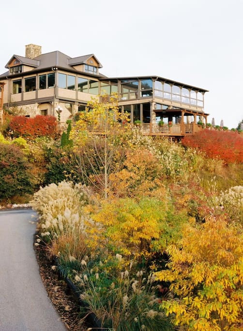
Wolf Mountain Vineyards
180 Wolf Mountain TrailMontaluce Winery and Restaurant
501 Hightower Church RdEl Jimador Mexican Restaurant
91 W Main StFarm House Produce
4690 GA-52Naturally Georgia
90 Public Square NYahoola Creek Grill
1810 South ChestateeBratzeit
77 Memorial DrCapers on the Square
84 Public Square N